Portofino Hiking Trails: Routes to San Fruttuoso, Monte di Portofino and Punta Chiappa
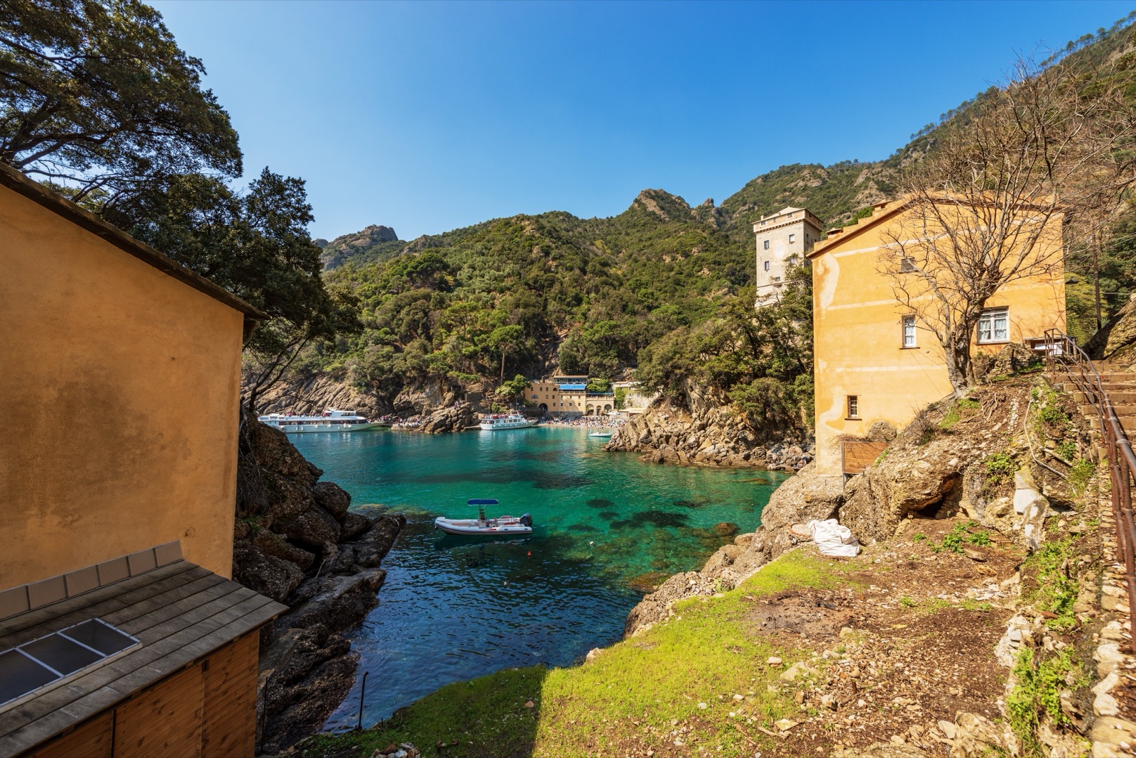
The classic Portofino hike is the path from Portofino village to San Fruttuoso: 4.3 km one way, 2 to 2 h 15 of walking according to the park authority, with about 250 m of climb and descent, graded E for average hikers. You walk out of the piazzetta, up through olive terraces and along a rugged coast to Base O, then drop steeply through pines to the abbey in its cove, and return by boat. It is the best introduction to a promontory that has about 80 km of paths and whose heart can only be reached on foot. This guide covers that walk and the other routes worth knowing, from an easy stroll out of Paraggi to the summit of Monte di Portofino and the exposed paths for experienced hikers, with the park’s own figures for each.
For the abbey, the Christ of the Abyss and the boats, see the San Fruttuoso and Portofino park guide; this page is about the walking.
The Portofino park in brief
The Portofino regional park was established in 1935 and covers 1,055 ha of land in the comuni of Camogli, Portofino and Santa Margherita Ligure. About 80 km of paths cross it, and its main gateways are San Rocco, Portofino Vetta, Nozarego and Portofino itself; the main destinations are Punta Chiappa, San Fruttuoso and Portofino. Most paths are old paved or earth tracks that once linked churches, hamlets, olive groves, woods and charcoal kilns, so they are often stepped, stony and steep rather than smooth.
The park authority publishes 22 walking itineraries with a route sheet for each, giving the length, walking time, height gained and lost, and a grade. Those sheets are the source of the figures below.
How to read the grades and times
The park uses the Italian Alpine Club (CAI) scale:
- T (for tourists): clear tracks and mule paths with modest gradients. Suitable for anyone used to walking, in proper shoes.
- E (average hikers): most of the park’s routes. Marked paths that can be steep, stony or uneven.
- EE (expert hikers): rough, sometimes exposed terrain where you need sure footing.
- EEA (expert hikers with equipment): protected paths and via ferrata sections where you need a via ferrata kit.
The walking times are indicative and leave out stops. They assume an average hiker climbing about 300 m an hour uphill, descending about 400 m an hour and walking about 4 km/h on the flat. Add time for photographs, a swim and lunch, and more on a hot day.
The best hikes at a glance
| Route | Distance | Time (one way unless a loop) | Climb / descent | Grade |
|---|---|---|---|---|
| Portofino – San Fruttuoso | 4.3 km | 2 – 2 h 15 | 250 m / 250 m | E |
| Paraggi – Portofino | 1.7 km | 40 – 50 min | 100 m / 100 m | T |
| Portofino Vetta – San Fruttuoso via Base O | 4.8 km | 1 h 40 – 2 h 10 | 100 m / 460 m | E |
| Summit of Monte di Portofino (loop) | 3.7 km | 1 h 50 – 2 h 15 | 250 m / 250 m | E |
| Camogli – San Rocco | 1.7 km | 45 min – 1 h | 200 m / 20 m | E |
| San Rocco – Punta Chiappa | 2.1 km | – | none / 220 m | T |
| San Rocco – San Fruttuoso via Pietre Strette | 4.6 km | 2 h 15 – 2 h 40 | 250 m / 460 m | E |
| Ruta – San Fruttuoso | 4.6 km | 2 – 2 h 30 | 210 m / 460 m | E |
| Nozarego – Portofino via Mulino del Gassetta | 4.6 km | 1 h 45 – 2 h | 150 m / 300 m | E |
| Portofino – Cala degli Inglesi | 2.5 km | 1 h 15 – 1 h 30 | 200 m / 200 m | EE |
| San Rocco – Batterie – San Fruttuoso | 6 km | 3 h 30 – 4 h 15 | – | EEA |
Portofino to San Fruttuoso
This is the walk most visitors mean when they talk about hiking in Portofino, and with good reason: it starts in the village, needs no car or bus, and ends at one of the most beautiful places on the Ligurian coast.
The route
The path starts at the western end of Piazza della Libertà, the square behind the harbour, and climbs the steep Via del Fondaco. Where the tarmac ends, a stepped path climbs the little valley of the Rio del Fondaco between olive terraces, with an unusual view back down over the village. At the top are the two houses of Cappelletta, at 186 m.
From Cappelletta, two branches on the left lead to Punta del Giasso and Cala degli Inglesi, both reserved for more experienced hikers. The San Fruttuoso path continues right to the Costa della Pineta (224 m), where the route to Ruta branches off, then turns left around a small valley and climbs to the houses of Prato (245 m). Prato’s vineyards are the ones behind the “Giancu de Portufin”, the Portofino white wine sung by Fabrizio De André.
Beyond Prato the path runs along the hillside through dry, rocky country with wide views of the sea, crosses the shaded valley of the Rio Ruffinale and climbs to Base O (228 m), 1 h 20 to 1 h 30 from Portofino. The name is a corruption of “ou”, gold, though you will often see it written “Base Zero”; the ruin of a small Second World War barracks stands here, and a short detour protected by chains leads to a spectacular viewpoint over the sea. From Base O the path drops steeply through a pine wood in many hairpins to San Fruttuoso, 40 to 45 minutes further on.
What it is like
The park grades it E. The climbing comes in short, steep sections rather than one long ascent, and the final descent to San Fruttuoso is the part that tires knees. Parts of the route are open to the sun, so in summer start early. Water is not guaranteed on the way.
Getting back
Most walkers return by boat. The Tigullio line links San Fruttuoso with Portofino, Santa Margherita Ligure and Rapallo almost all year, and the operator’s 2026 fare table lists Portofino–San Fruttuoso at €12.00 one way and €20.00 return. Golfo Paradiso’s boats run from San Fruttuoso to Punta Chiappa and Camogli all year. Boats only sail in favourable sea conditions, so if the sea is rough you must be ready to walk back the way you came. Check the last boat before you set off: in 2026 the last boat from San Fruttuoso to Camogli left at 17:00 in April, May and October, 18:00 in June and September and 19:00 in July and August.
Paraggi to Portofino: the easy option
If you want a walk rather than a hike, the route from Paraggi to Portofino is the park’s gentlest way into the village: 1.7 km, 40 to 50 minutes one way, about 100 m up and down, graded T. Paraggi is reached by AMT bus or by car from Santa Margherita Ligure. It is a pleasant alternative to walking the road, and you can combine it with the coastal walk from Santa Margherita (about 5 km in all) or simply return by bus 782.
From Paraggi the park also describes the Acqua Viva loop: 3.6 km, 2 to 2 h 45, about 250 m up and down, graded E, through the valley that once powered Paraggi’s water mills.
Nozarego to Portofino and the Santa Margherita path
From Santa Margherita Ligure the park’s path starts in the Corte quarter and climbs to Nozarego, then continues through woods to the Mulino del Gassetta (252 m), a park information point, refreshment stop and small museum with a picnic area. Along the way, the viewpoint over the Cervara abbey is at 174 m.
The park’s sheet for Nozarego to Portofino via the Mulino del Gassetta gives 4.6 km, 1 h 45 to 2 h one way, about 150 m up and 300 m down, graded E. Nozarego’s church is reached by car from Santa Margherita. This is a good choice on a hot day, as much of it is wooded.
For a longer day, the park describes Santa Margherita Ligure station to San Fruttuoso via Pietre Strette: 6 km, with about 460 m of climb and 480 m of descent, graded E. Starting from the railway station, it needs no car at all.
Portofino Vetta and the summit of Monte di Portofino
Portofino Vetta is a car park at 391 m, reached by a lane from the western end of the Ruta tunnel, on the road between Camogli and Rapallo. From here the walks start high, which makes them less tiring than the routes from sea level.
The summit loop
The summit loop of Monte di Portofino is 3.7 km, 1 h 50 to 2 h 15, about 250 m up and down, graded E. It climbs from the junction of Gaixella (408 m) through mixed woodland to the clearing at the top of Monte di Portofino, at 608 m, the highest point of the promontory. Here stands the Semaforo Vecchio, a signal station built by Napoleon’s army engineers in 1807 for flag and later telegraph signals and now used as a park refuge, with picnic tables nearby. Fog so often hid the summit that in 1880 a new signal station, the Semaforo Nuovo, was built lower down. Behind the Semaforo Vecchio a short, slightly rough detour leads to a viewpoint over both the Golfo Paradiso and the Gulf of Tigullio at once.
The loop returns via Porcile and Paradiso (521 m), where a detour leads to the Rocca del Falco, a conglomerate spur looking over Camogli and the western coast of the promontory.
Two more loops
- Anello Alto (high loop): 4.7 km, 1 h 40 to 2 h 10, about 250 m up and down, graded E.
- Anello Basso (low loop): 5.3 km, 2 h 30 to 3 h 10, about 250 m up and down, graded E.
Down to San Fruttuoso from the top
Portofino Vetta to San Fruttuoso via Base O is 4.8 km, 1 h 40 to 2 h 10 one way, about 100 m up and 460 m down, graded E. It passes the Pietre Strette (464 m), a pass cut between towers of rock that is the main crossroads of the park’s paths and one of its geosites, then Felciara and Ghidelli, and meets the Portofino path at Base O before the final descent. Because it is mostly downhill, it is the easiest way to reach San Fruttuoso on foot, but you will need to get back to Portofino Vetta or arrange transport.
From Camogli: San Rocco and Punta Chiappa
The western side of the promontory is reached from Camogli, on the railway. From Camogli station to the start of the walk towards San Fruttuoso is about 300 m.
- Camogli to San Rocco: 1.7 km, 45 minutes to 1 hour, about 200 m up and 20 m down, graded E, up a stepped mule path. San Rocco, at 221 m, can also be reached by car or bus from Ruta. Its church looks out over the Golfo Paradiso.
- San Rocco to Punta Chiappa: 2.1 km, all downhill with about 220 m of descent, graded T. It passes San Nicolò di Capodimonte, a Romanesque church, and ends at Porto Pidocchio and Punta Chiappa, a huge slab of conglomerate running into the sea, where boats from Camogli and San Fruttuoso land.
- San Rocco to San Fruttuoso via Pietre Strette: 4.6 km, 2 h 15 to 2 h 40 one way, about 250 m up and 460 m down, graded E, across the north-western face of Monte di Portofino.
- Ruta to San Fruttuoso: 4.6 km, 2 to 2 h 30 one way, about 210 m up and 460 m down, graded E, from the Camogli side of the Ruta tunnel.
The town itself is covered in the Camogli article.
The expert routes
Some of the most dramatic paths are not for everyone:
- San Rocco – Batterie – Passo del Bacio – San Fruttuoso: 6 km, 3 h 30 to 4 h 15, graded EEA. The section from the Batterie to San Fruttuoso needs a via ferrata kit. The park’s page says this section is currently closed, so check before you set out.
- Via dei Tubi loop from San Rocco: 8.5 km, 4 h 30 to 5 h 30, about 400 m up and down, graded EEA.
- Portofino to Cala degli Inglesi: 2.5 km, 1 h 15 to 1 h 30 one way, about 200 m up and down, graded EE.
- Portofino to Punta del Giasso: 1.6 km, 1 to 1 h 15 one way, about 180 m up and down, graded EE.
Do not attempt the EEA routes without the right equipment and experience, and avoid the EE paths in wet weather, when the conglomerate and earth become slippery.
The long way: Portofino to Camogli
On the long-distance Sentiero Liguria, stage 10 runs from Portofino to Camogli and takes 6 h. You can walk it as a full day across the promontory, via San Fruttuoso, and return by train from Camogli. The park’s Ruta to Portofino route is a shorter crossing: 7.4 km, 2 h 10 to 2 h 45 one way, about 210 m up and 460 m down, graded E.
Short walks from the village
Not every walk needs boots. From the piazzetta, the walk to the Punta del Capo lighthouse takes about 20 minutes, passing the church of San Giorgio and Castello Brown, with plenty of shade. It is covered in the Portofino village guide, and it pairs well with a morning on the San Fruttuoso path.
Planning your hike
When to go
Spring and autumn are the best seasons: cooler air, flowers in spring, clear light after the autumn rains. Summer is hot on the exposed sections, and the afternoons can bring thunderstorms; in summer 2025 frequent thunderstorms, especially in July and August, led to 7 yellow and 2 orange weather alerts in Liguria. Rain is most frequent in October and November. Check the forecast on the Portofino weather page and the daily alert level on Allerta Liguria before you go.
Getting to the trailheads
- Portofino: bus 782 from Santa Margherita Ligure, or the ferry.
- Paraggi: bus 782 stops there.
- San Rocco: on foot from Camogli station, or by car or bus from Ruta.
- Portofino Vetta: by car from the western end of the Ruta tunnel.
- San Fruttuoso: boats from Camogli all year and from Portofino, Santa Margherita and Rapallo in season.
Combining a walk one way with a boat the other is the most popular plan; see getting to Portofino for buses and ferries.
What to bring
- Proper shoes with grip: the paths are stony and stepped.
- Water: more than you think, especially in summer.
- Sun protection: hat and sun cream for the exposed coast.
- Swimwear: there is a small beach at San Fruttuoso.
- Cash or card for the boat back, and for the abbey (€10) if you plan to visit.
- A map or the park’s GPS tracks: junctions are signed, but there are many of them.
Rules and respect
The whole territory of the comune of Portofino lies inside the regional park and the marine protected area. Stay on the marked paths, take your rubbish with you, do not pick plants and keep dogs under control. The paths pass through private olive groves and gardens, so respect gates and walls.
Walking with children
The Paraggi to Portofino walk (graded T) and San Rocco to Punta Chiappa (downhill, graded T, with a boat back from Punta Chiappa) are the best choices with children. The Portofino to San Fruttuoso path is manageable for older children used to walking, but the final descent is steep.
Accessibility
The park’s paths are not suitable for wheelchairs or pushchairs: almost all involve steps and uneven ground. The harbour front in Portofino is level, and the boats to San Fruttuoso are an alternative way to see the coast, though the landing involves steps.
If you would rather see the headland from the water, a guided kayak tour to Portofino from Paraggi follows the coast below the paths.
Frequently asked questions
How long is the hike from Portofino to San Fruttuoso?
The park gives 4.3 km and 2 to 2 h 15 one way, with about 250 m of climb and descent, graded E for average hikers. Base O, where the steep descent to San Fruttuoso begins, is 1 h 20 to 1 h 30 from Portofino.
Is the Portofino to San Fruttuoso hike difficult?
It is a moderate hike with short steep sections, especially the descent to San Fruttuoso. Good shoes and water are essential; it is not suitable for pushchairs.
What is the easiest walk in Portofino?
The walk to the lighthouse, about 20 minutes from the piazzetta, and the park’s Paraggi to Portofino path, 1.7 km and 40 to 50 minutes, graded T.
How high is Monte di Portofino?
The summit clearing is at 608 m. The park’s loop from Portofino Vetta takes 1 h 50 to 2 h 15.
Can I walk to San Fruttuoso and take the boat back?
Yes. Boats link San Fruttuoso with Portofino and with Camogli, but only in favourable sea conditions, so check the last departure and the forecast before you set off.